SeaTV · Greece · Cruising Region
Saronic Gulf & Eastern Peloponnese — Sailing Guide
A semi-enclosed gulf south of Athens — short sailing legs, varied islands, ancient temples within walking distance of the boat. The perfect first-week cruising area in Greece, and the most reliable when the Meltemi is howling everywhere else.
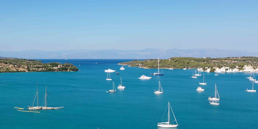
The Saronic Gulf sits between Attica (Athens) and the Peloponnese — a partially enclosed gulf scattered with islands at every distance: Aegina just south of Piraeus, Agistri its quieter neighbour, Poros barely separated from the mainland, then Hydra, Spetses, and the Eastern Peloponnese coast forming the southern arc. Within a 30-mile diameter you’ll find car-free island towns, classical temples, sulphur hot springs, ancient theatres still in use, and protected wildlife islets — all reachable on short, manageable legs.
For sailors, this is the area that gets recommended first to anyone chartering out of Athens for the first time. Short legs, sheltered water, mild Meltemi compared to the Aegean, well-stocked harbours. Even seasoned skippers come back for the variety: a Saronic week visits more distinct atmospheres than most Greek cruising regions twice the size.
This is the SeaTV regional hub for the Saronic Gulf and Eastern Peloponnese. Every anchorage, port, and route on the page links to a dedicated SeaTV docking page with full mooring detail, coordinates, hazards, and shore information.
⚠ Reality check before you sail the Saronic:
→ Traffic Separation Scheme west of Athens — big-ship lanes. Cross at right angles, give way
→ Hydra docking is demanding — arrive before 11:00 or use Mandraki
→ Aegina approach has reefs from natural extensions and ancient artificial defences
→ Poros channel is 200 m wide with ferry traffic at speed
→ No anchorage gives full shelter from all directions — pick by forecast, not preference
⚓ Quick Facts for the Saronic Sailor
Charter base
Alimos Marina, Athens (largest in Greece)
Region size
~30 NM diameter · semi-enclosed
Typical leg
8–25 NM between stops
Meltemi character
Gentler than Cyclades · 4–5 Bf typical
Best season
May–June · September–October
Mooring style
Stern-to with anchor laid (Med-mooring)
Geography & Wind Patterns
The Saronic Gulf is bounded by the Attica peninsula (Athens) to the north-east, the Peloponnese to the west, and a chain of islands forming the southern arc. Approach from the open Aegean is via the Saronic Gulf entrance south of Aegina. Depths in the gulf are generally 20–50 m, reducing to 5–10 m near harbours. Sea state is generally slight to moderate due to limited fetch — the Saronic version of the Meltemi is much gentler than what hits the Cyclades.
The Meltemi in the Saronic
The Meltemi (Etesians) is the dominant summer wind across the Aegean — a strong, dry northerly that builds through July and August. In the Saronic, however, the gulf is partially sheltered by the Attica peninsula and Aegina. Expect 4–5 Bf (sometimes 6) where you’d see 6–8 Bf in the Cyclades. Waves are lower because of the limited fetch.
The exception: Around Poros and through the channel, waves can build more than the rest of the gulf. And in the southern Saronic — south of Hydra, near Spetses — you’re in more open water and the Meltemi has more space to organise itself.
Argolic Gulf wind context
The southern arm — the Argolic Gulf running NW–SE — is surrounded by high mountains on both sides. Winds inside the gulf typically blow parallel to the shore at 10–20 knots, channelled by the topography. You may find a different wind direction inside the gulf than what’s reported for the open Aegean, especially in morning/evening transitions.
Approach hazards across the region
→ Aegina: Reefs from Agistri and Metopi · NW–SE reef across the entrance to Aegina Port
→ Poros: Narrow 200 m channel · shallows · ferries at speed
→ Spetses: Reef in the entrance to Baltiza Old Harbour · 200 m reef off the Ferry Terminal
→ Ermioni: Ancient mole on north side of headland
→ Athens crossing: Traffic Separation Scheme · big-ship lanes
The Recommended 6-Day Saronic Route
SeaTV’s recommended route for a perfect first week — six days of varied cruising from Athens covering Aegina, Perdika, Ermioni, Hydra, Poros, Agistri, and Moni Bay, with breakfast and lunch stops at quiet anchorages along the way.
Day 1: Alimos Marina (Athens) → Agia Marina (lunch) → Perdika · ~20 NM
Day 2: Perdika → bay-stop for lunch → Ermioni
Day 3: Ermioni → Skindos Dokos (breakfast) → Hydra · ~8 NM
Day 4: Hydra → Nisos Gali (lunch) → Poros channel → Poros
Day 5: Poros → past Methana → Skilomango West Bay → Aegina Port
Day 6: Moni Bay (final swim) → return to Alimos
→ Full 6-Day Saronic Route page with day-by-day detail
⚓ All Anchorages & Ports — Region Catalogue
Every Saronic stop with its character at a glance. Click through to the dedicated SeaTV page for full mooring detail, coordinates, approach hazards, and shore information.
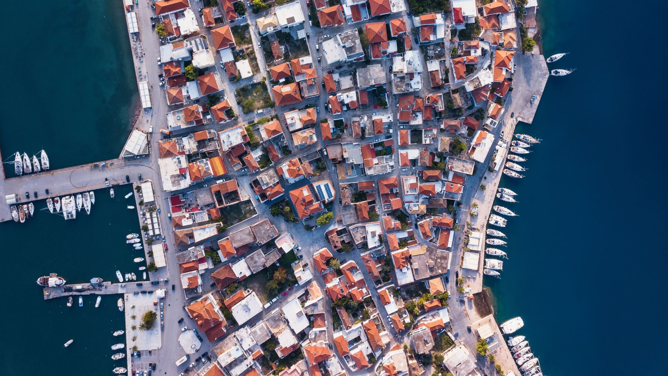
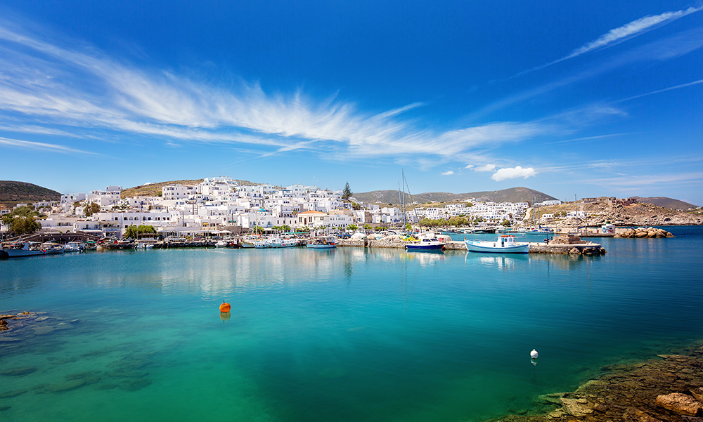
Aegina Island & Anchorages
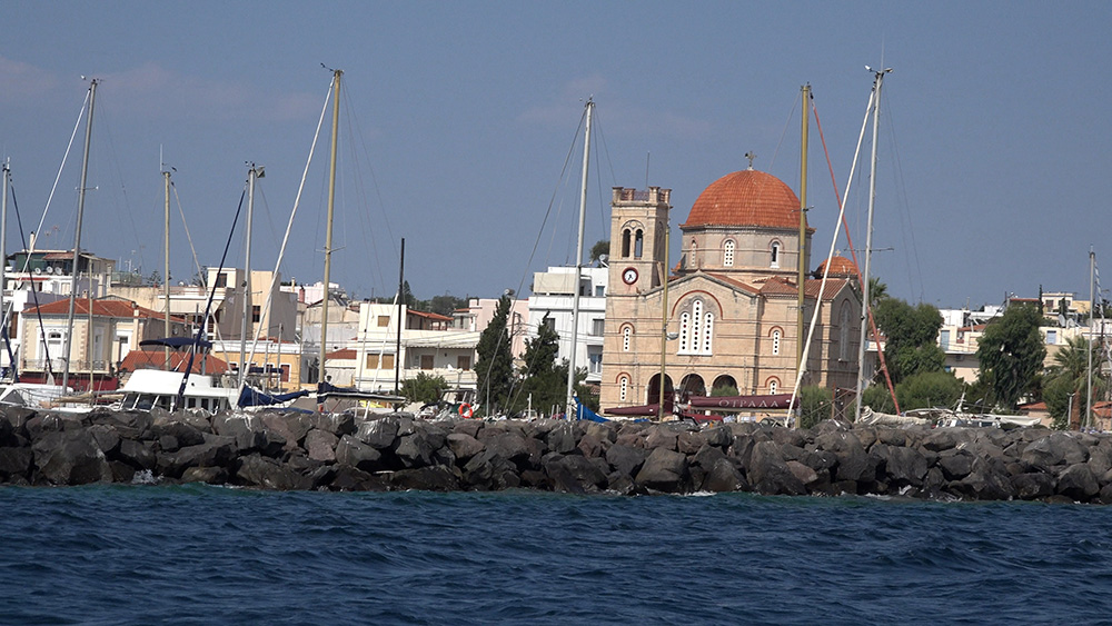
Aegina Port · 37°44’40″N · 23°25’41″E
Aegina Port (Egina)
Working main port of the island — neoclassical waterfront, pistachios, ferry traffic. Stern-to the town quay; reef on approach with red buoy at SE end.
Limits: Max draft 2.4 m · max LOA 40 m · Aigina Marina not for visitors. Arrive before 14:00.
Best Anchorages of Aegina · 5 bays
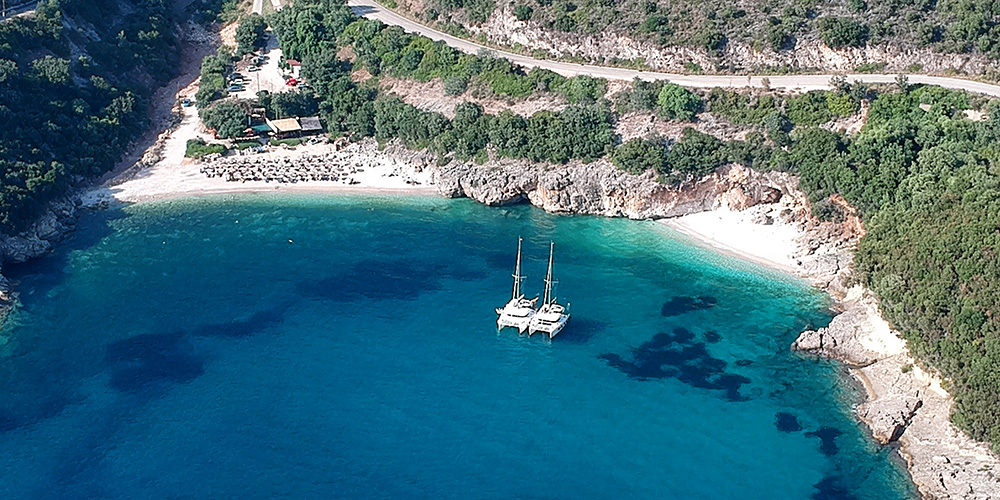
Best Anchorages of Aegina
Agia Marina (E): L-shaped mole, gateway to Temple of Aphaia, exposed to easterlies
Kipos (SE): NNW shelter, sand, quiet
Klima (S): Horse-shoe bay, N+E shelter, snorkelling
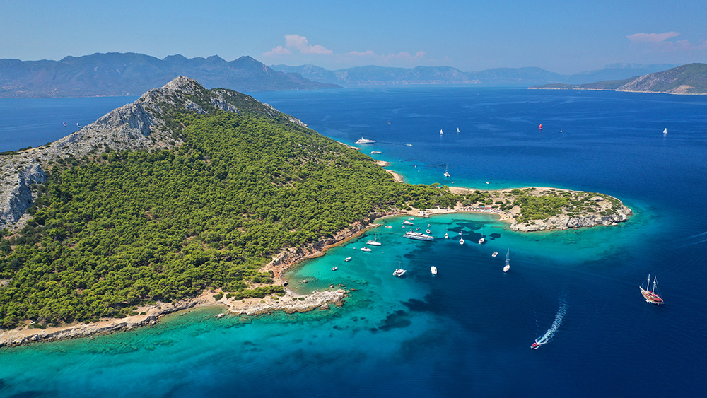
Perdika (SW): Greek fishing village, multiple piers, Mt Oros hike
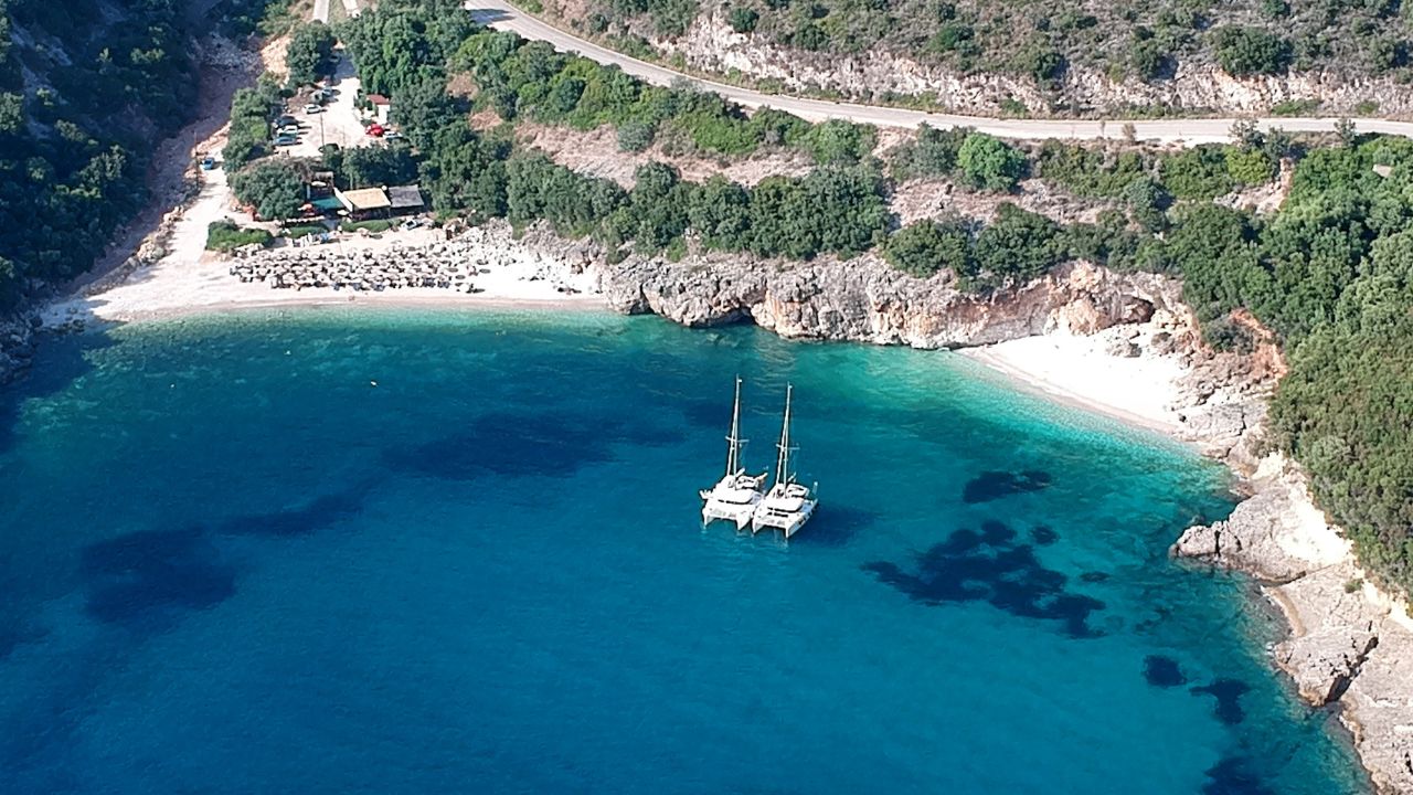
Moni Bay (off SW): Protected nature reserve, peacocks & deer, sand bottom
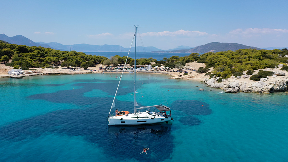
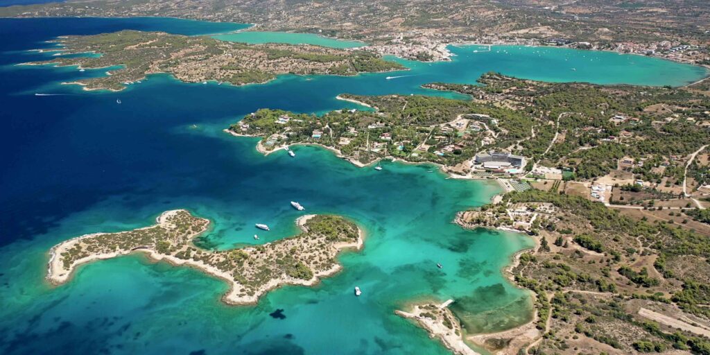
Agistri Island
Agistri · 4 NM W of Aegina
Best Anchorages of Agistri
Pine-forested neighbour of Aegina with four good natural anchorages and one small port (Megalochori). Smaller, quieter, and less developed than its larger neighbour.
Anchorages: Skilomango West (large, NW shelter) · Saronikos · Dragonera Beach (5–10 m, crystal water) · Megali Bali (calm-weather)
Port: Megalochori (NW side, NE-SE shelter) · phone +30 22970 91541 · ⚠ Metopi reefs from east approach
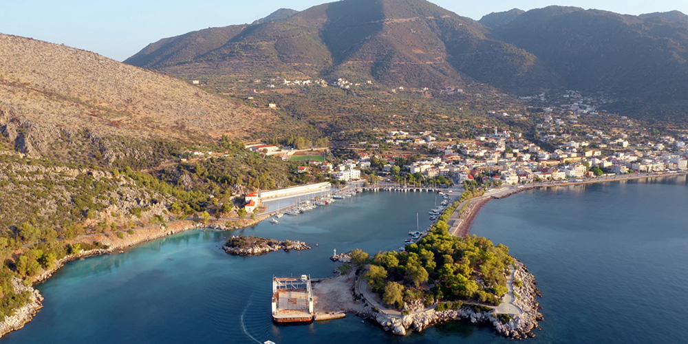
Methana Peninsula
Methana · Volcanic peninsula · 3 locations
Methana Anchorages
Volcanic peninsula in the southern Saronic — sulphur hot springs near the marina, dormant volcano hike, three different mooring options.
Methana Marina: 1.5–3 m depth · max LOA 45 ft · advance booking
Ferry Quay: VHF Ch. 02 · 30 berths · max draft 5 m · max LOA 30 m
Vathi: Small fishing village, west coast · ~15 yachts
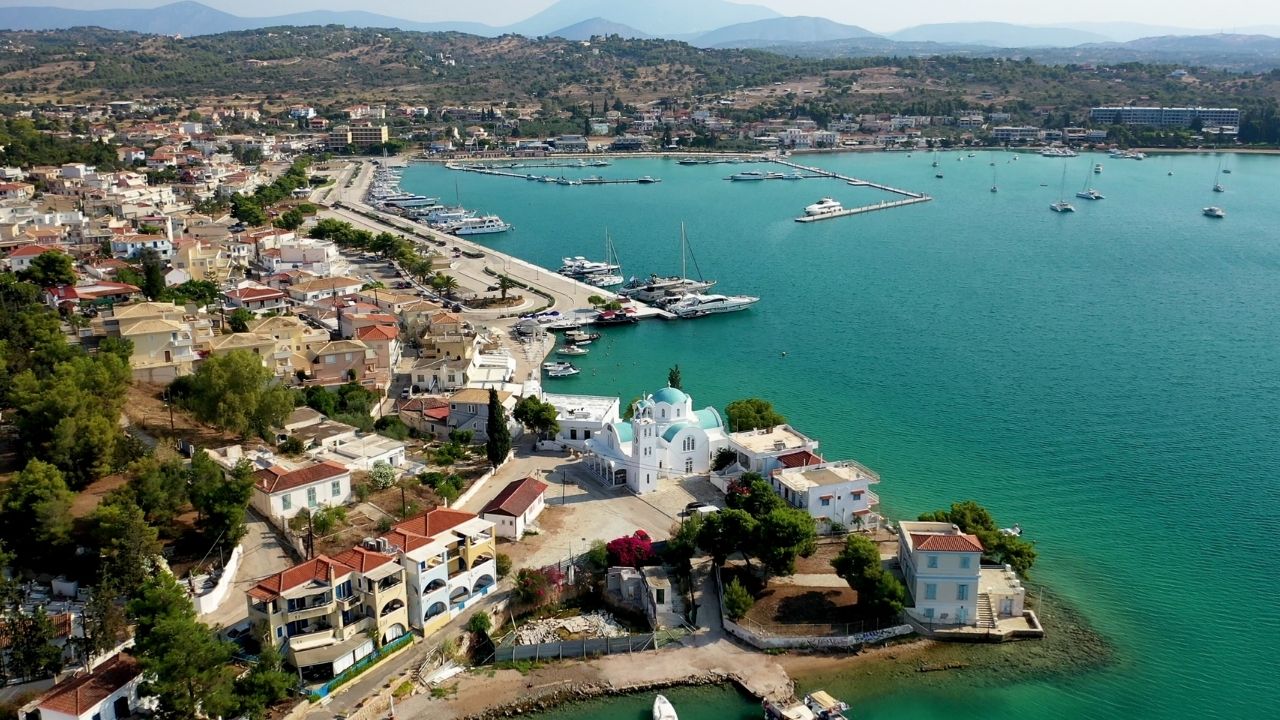
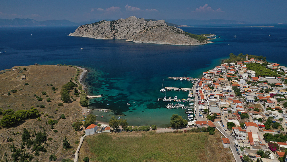
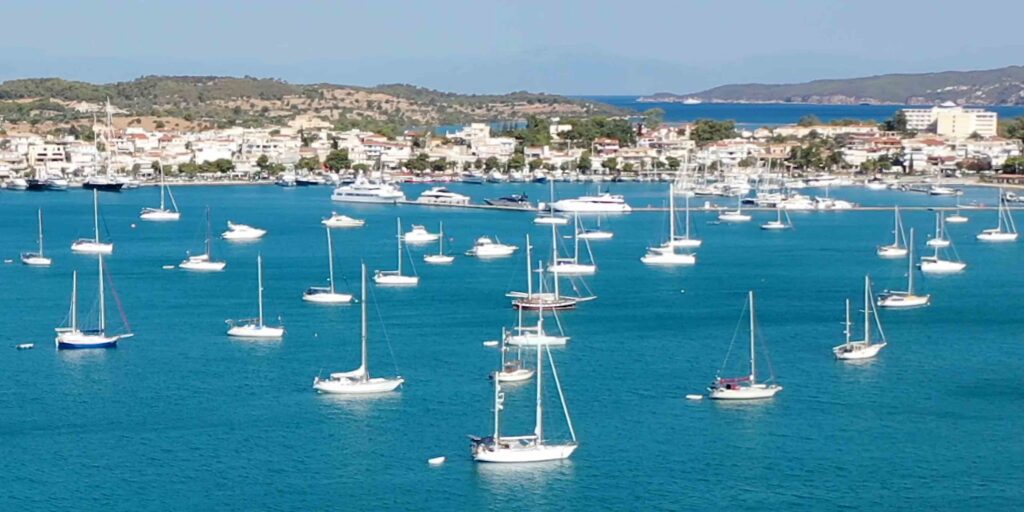
Poros Island
Poros · ~18 NM south of Athens
Poros Island Anchorages
200 m channel separates the island from the Peloponnese — the Saronic’s most walkable harbour, with neoclassical town, multiple quay sections, and Russian Bay west of town.
Mooring: South Quay (chain 20m W / 30m E) · North Quay (20–30m chain) · Floating Platform (no services) · Russian Bay (37°31.10’N · 23°26.02’E, ⚠ 50m reef E of islet)
Fuel: Mini-tanker · +30 6934 887 522
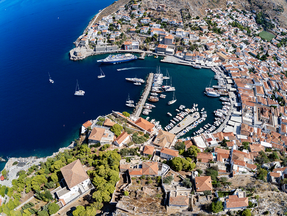
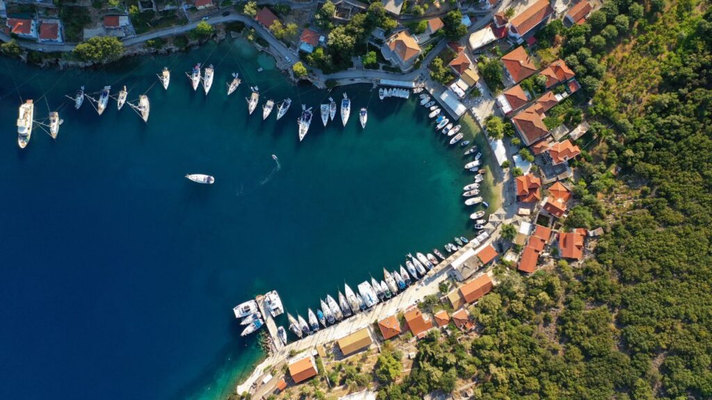
Hydra Island
Hydra · Car-free island
Hydra Island Anchorages
The most-photographed Saronic harbour and the most demanding to dock in. Cars/motorcycles/bicycles banned; only donkeys, water taxis, and feet. No natural water on the island.
Critical timing: Arrive by 11:00 · full by 14:00 · spare anchor rigged · don’t dive own anchor (fine!)
Mandraki Bay: 1 NM east, 15–20 m + line ashore, water-taxi to town — the calmer alternative
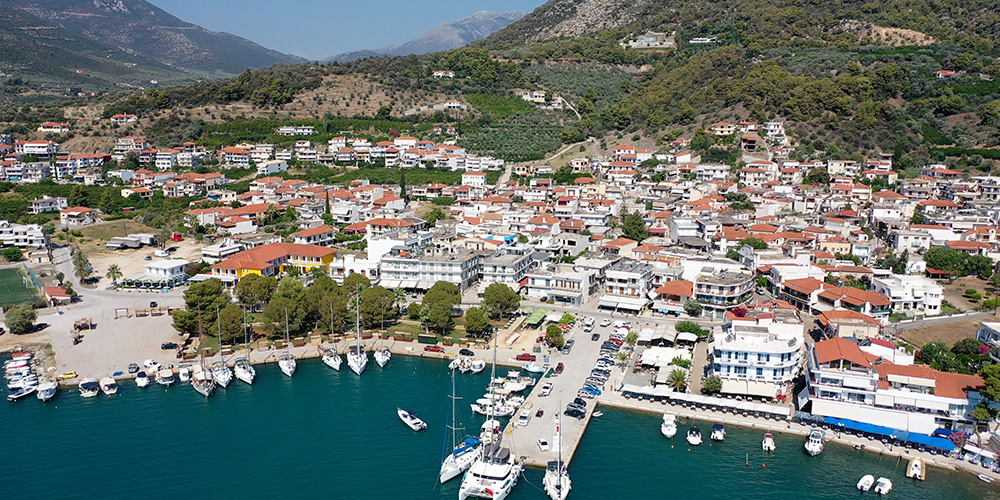
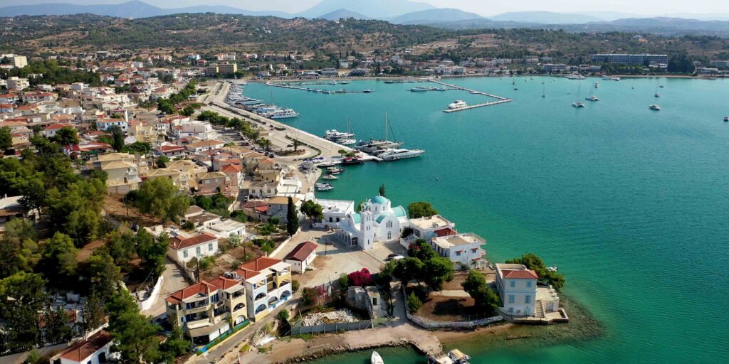
Ermioni
Ermioni · 37°23.20’N · 23°14.92’E
Ermioni
Peninsula village on the Eastern Peloponnese, opposite Hydra. Two quays — one each side of the village, 5-minute walk between. Pick by wind direction (N/NW → Southern Quay, S/E → East Town Quay).
Highlights: Thursday market (regional shoppers) · water-taxi to Hydra · big supermarket · authentic Greek atmosphere
⚠ Watch: Ancient mole on N side of headland
Spetses Island
Spetses · 4 anchorages
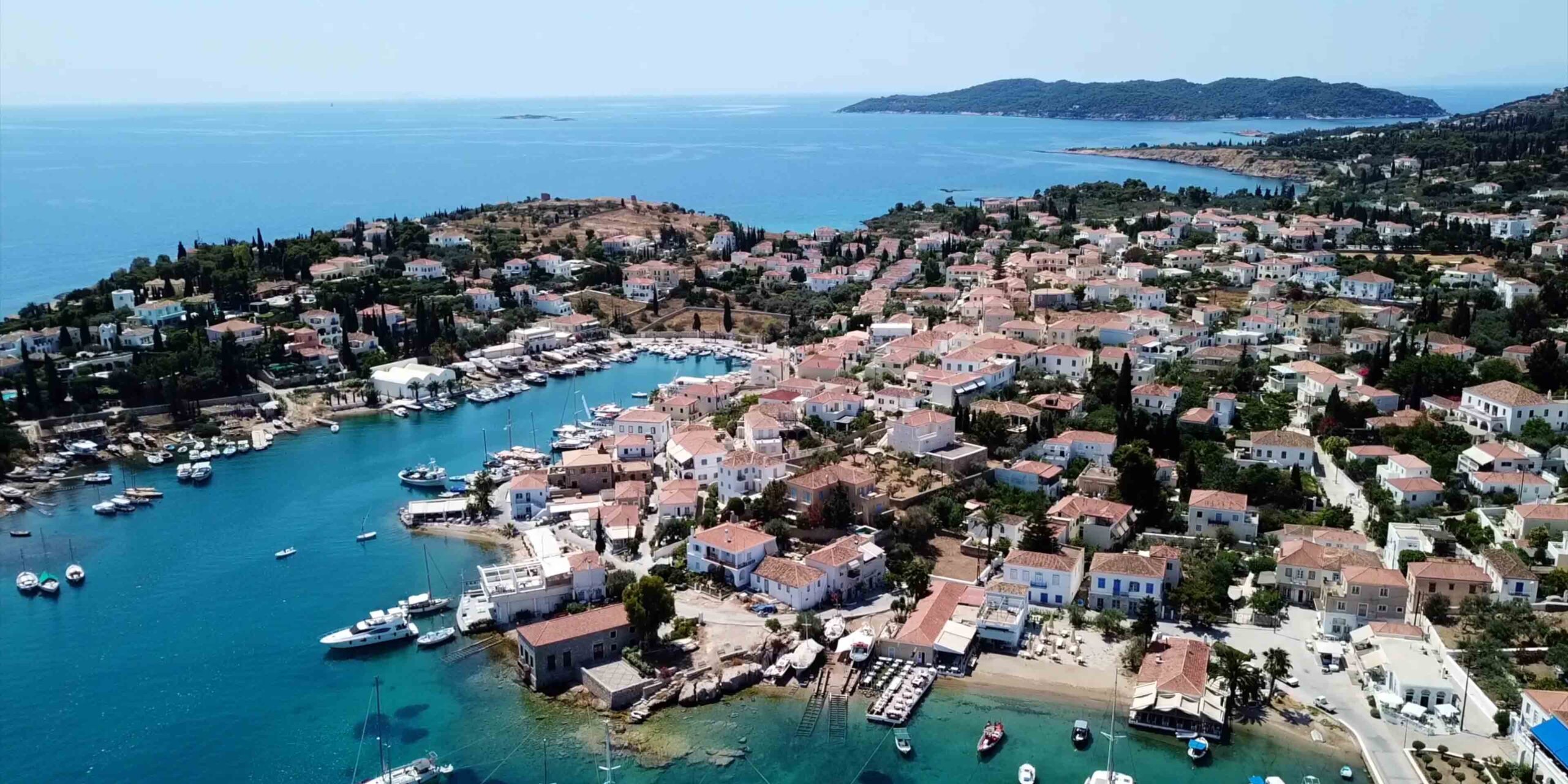
Spetses Island
Pine-forested cosmopolitan island between Saronic and Argolic Gulfs. Four very different anchorages on one short coastline.
Baltiza Old Harbour: Lively, crowded, lighthouse on E side, ⚠ rocks/reef in entrance
Ferry Terminal: 1 NM W of Old Port, ⚠ reef 200 m off shore
Paralia Zogeria: NW open bay, calm-weather only
Anargiri Bay: SW open bay, “love-cave” on N side, settled-weather overnight
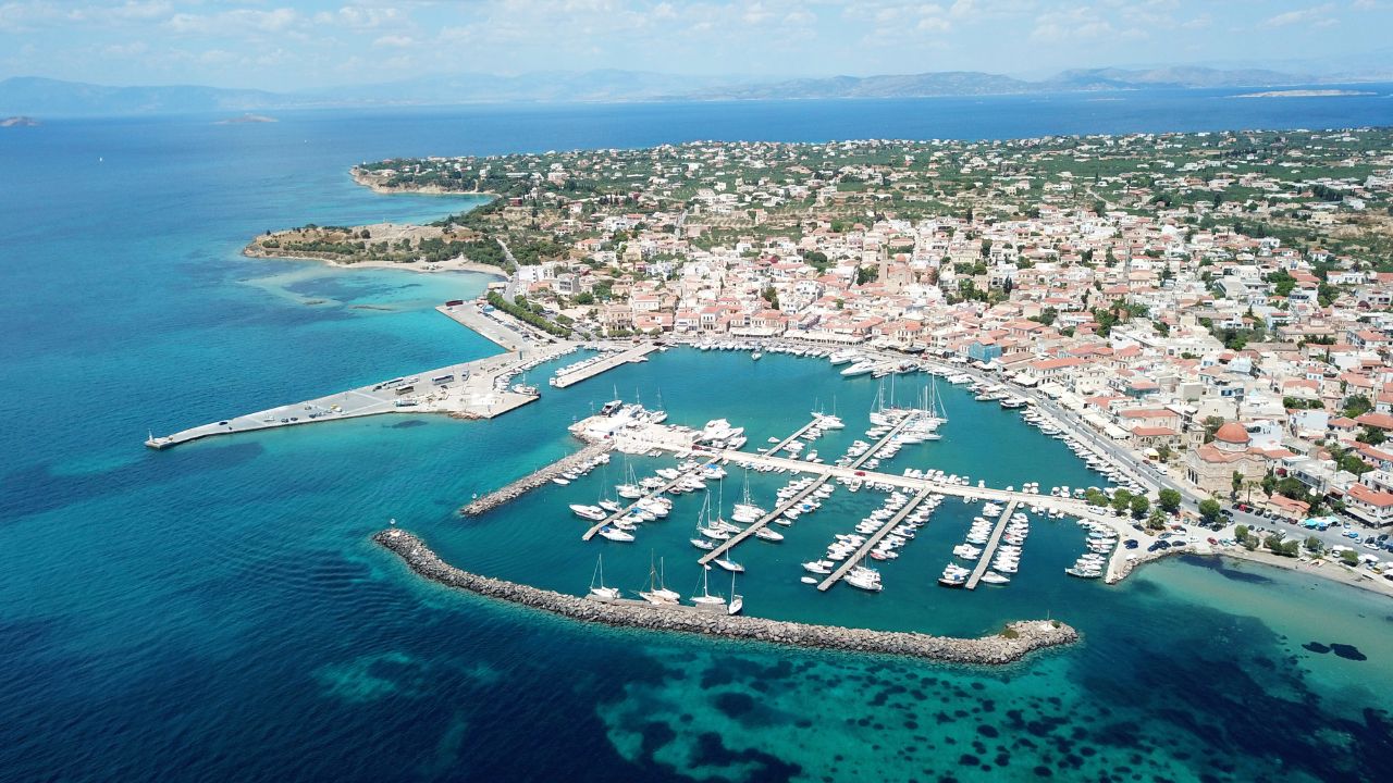
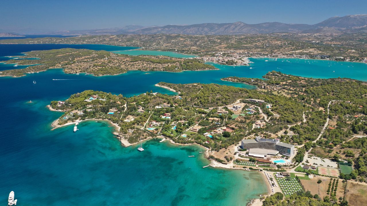
Porto Cheli
Porto Cheli · 37°19’27.7″N · 23°08’43.8″E · 3.7 NM N of Spetses
Porto Cheli
Wide, almost fully-enclosed bay on the Eastern Peloponnese — one of the most reliable overnight stops in the Saronic. Mud-bottom holding, all-around shelter, a marina (149 berths, VHF Ch. 88) for those wanting full services.
Best for: Reliable shelter when conditions get unsettled · provisioning · marina overnight
⚠ Watch: Cape Ayios Aimilianos rocks on east approach · S side of bay shallow
Nea & Palaia Epidavros
Epidavros · Eastern Peloponnese · 3 locations
Nea & Palaia Epidavros
Gateway by sea to the most-acclaimed ancient theatre in Greece — built 4th century BC, still in active use, famous acoustics. The cultural-stop choice.
Old Port Epidaurus: 37°38’14.6″N · 23°09’29.5″E · phone +30 8961 195 560 · taxi to theatre 20 min
Magical Bay: 37°38’51.3″N · 23°09’55.1″E · 10–15 m + line ashore · settled weather
Nea Epidavros: 37°40’44.5″N · 23°09’10.3″E · phone +30 27530 41216 · sheltered alternative
⚠ Both bays open east
Cultural Highlights — From the Cockpit
The Saronic is one of the few cruising regions in Greece where you can walk from the boat to a major archaeological site or ancient theatre. The four big cultural draws:
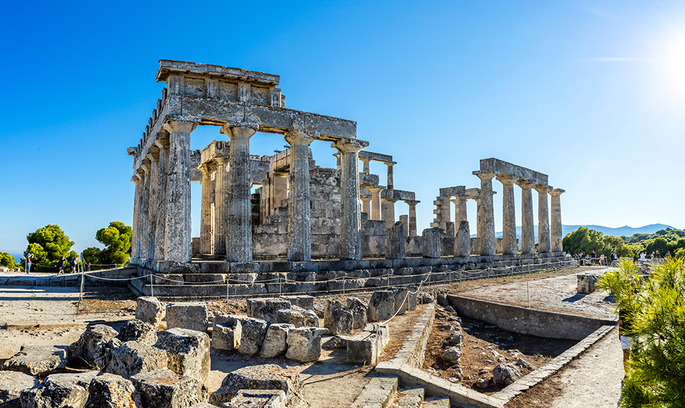
Temple of Aphaia (Aegina): One of the best-preserved Doric temples in Greece, built ~500 BC, contemporary with the Parthenon. Forms the famous “sacred triangle” with the Parthenon (Athens) and the Temple of Poseidon at Sounion. From Agia Marina anchorage: 1.7 km uphill walk (30–45 minutes) or €20 taxi.
Theatre of Epidaurus: Built 4th century BC, still in active use for summer performances of ancient Greek drama. Renowned for classical architecture and outstanding acoustics — a whisper from the stage carries to the back row. UNESCO World Heritage. From Old Port Epidaurus: 20 min taxi.
Hydra’s stone town: Car-free, working donkeys, neoclassical mansions on a steep amphitheatre, thriving art scene with galleries and museums. The walk up to the Profitis Ilias monastery is the best vantage point on the island.
Spetses Old Town: Car-free centre, neoclassical mansions, working horse-cart taxi service, the Bouboulina Museum. Worth at least one evening walk.
Wildlife & nature: Moni islet (protected since 1962, peacocks & deer roaming the pine forest), Methana volcano crater (30 min walk), Mt Oros from Perdika (highest point in the Saronic at 534 m).
When to Sail the Saronic
May–June: Stable weather, fewer charter crowds, comfortable temperatures, Meltemi just starting. The classic SeaTV pick for a Saronic week.
July–August: Hot, crowded, with the highest Meltemi probability. Hydra and Aegina Port fill earlier; book ahead. Worth doing if you’re tied to school holidays, but a less relaxed experience.
September–October: The other strong season — Meltemi easing, water still warm from summer, fewer crowds, longer light. Good for crews wanting unhurried evenings.
November–April: Off-season. Some berths available, few facilities, frontal weather systems, cold. Possible for shake-down sails but not for a charter week.
Provisioning Strategy
The Saronic is well-served for provisioning compared to more remote Greek regions, but stocking points are concentrated:
Best provisioning ports: Aegina Town (multiple supermarkets including AB Vassilopoulos), Poros (5-minute walk from quay), Ermioni (big supermarket + Thursday market), Porto Cheli (full range). Stock here for the week ahead.
Limited stops: Hydra (basics only — small shops in town), Spetses (varied but expensive), Methana (working town with basic shops), Agia Marina/Agistri (smaller markets, routine resupply only).
No provisioning at anchor: Moni Bay, Magical Bay, Russian Bay, all the smaller coves. Plan ahead.
Local specialty: Aegina pistachios — Protected Designation of Origin status, sweeter and richer than other varieties. Buy directly from the waterfront in Aegina Town, not from the airport.
Fuel: Available at most Saronic harbours by mini-tanker delivery — call ahead. Aegina (+30 22970 22708) and Poros (+30 6934 887 522) are the main service points. No fuel quay on Hydra (top up at Porto Cheli or Ermioni first).
⚠ Saronic Hazard Summary — All Reefs and Tight Spots
A consolidated list of every notable navigation hazard across the Saronic. Plot all of these on the chartplotter before the week begins:
Athens crossing: Traffic Separation Scheme — big-ship lanes, cross at right angles
Aegina approach: Reefs from Agistri/Metopi (natural) + ancient artificial reefs
Aegina Port entrance: NW-SE reef + red buoy at SE end · 5–6 m approach depth
Agistri (Megalochori): Reefs and shoal water between Agistri and Metopi (eastern approach)
Methana Marina: 1.5–3 m depth, max 45 ft LOA, narrow entrance
Poros channel: 200 m wide · shallows · fast ferries · narrow southern entrance hidden
Russian Bay (Poros): 50 m reef on east side of islet
Hydra Port: Narrow entrance · Med-mooring raft 2-3 deep · crossed anchors
Ermioni: Ancient mole on north side of headland
Epidavros (Old Port): Two-buoy channel, bay open to east
Spetses (Baltiza): Above-water rocks + short reef in entrance
Spetses (Ferry Terminal): Reef 200 m off shore between moorings
Porto Cheli: Cape Ayios Aimilianos rocks on eastern approach
SeaTV’s Top Tips for the Saronic
Inspect the anchor at check-in. The Saronic uses anchors heavily — most overnights are stern-to with the anchor laid. The state of your charter boat’s anchor and chain is the single most important thing for the week. Inspect the windlass, the chain, the anchor itself, the second anchor (if any).
Default to early arrivals. Hydra, Aegina Port, and Spetses Baltiza all have a “before 11:00 / before 14:00” rule. Even where they don’t, peak-season afternoons are when crossed anchors and tight slots become a headache.
Pick anchorages by wind, not preference. No Saronic anchorage gives full shelter from all directions. Check the morning forecast and let it dictate the day’s choices. The decision logic is on each individual page.
Use water-taxis for Hydra. Anchoring at Mandraki or Ermioni and taking the water-taxi to Hydra for the evening is the calmer way to experience the island. You get the town without the morning raft drama.
Eyeball the heat haze. The Athens-to-Aegina leg is famous for heat haze that drops visibility. Use the chartplotter rigorously, watch for fishing markers and rocks. The visibility drop is normal; not a sign to push harder.
Time the temple for sunset. The Temple of Aphaia at Aegina and the Theatre of Epidaurus both reward late-afternoon visits. Walk up in the cooler late-day light, see the site at golden hour, walk back as the sun sets across the gulf.
Fenders and lines accessible. Med-mooring is the standard. Have fenders and stern lines rigged before approach to every harbour, not after. Charter crews who fish them out at the last minute are the ones rafted at the back.
Buy pistachios in Aegina Town. Don’t leave the region without a kilo of Aegina pistachios from the waterfront. PDO status, distinctive flavour, and significantly better than what you’ll find at the airport.
Licensing & Charter Requirements
Skipper qualification: ICC (International Certificate of Competence) or recognised national equivalent (RYA Day Skipper Practical, ASA 104, etc.) is required for bareboat charters.
Co-skipper: A named co-skipper aged 18+ is required by most charter companies.
VHF SRC: Short Range Certificate is advisable; some charter companies now require it.
Insurance documents: Carry a Greek translation of the boat’s insurance — useful at port authorities and harbour-master offices.
Emergency & Service Numbers — Saronic Region
European Emergency: 112
Coastguard Distress (VHF Ch. 16): Universal
Coastguard Working (VHF Ch. 12): Per region
Aegina Fuel (service): +30 6932 625 501
Aegina Fuel (mini-tanker): +30 22970 22708
Poros Fuel (mini-tanker): +30 6934 887 522
Methana Ferry Quay: VHF Ch. 02
Marina Porto Heli: VHF Ch. 88 · 149 berths · advance booking
Megalochori (Agistri): +30 22970 91541
Old Port Epidaurus: +30 8961 195 560
Nea Epidavros: +30 27530 41216
Olympia Radio (VHF Ch. 03/86): Greek HF/VHF maritime service
Watch the SeaTV Visual Pilot Videos
Every Saronic anchorage has its own SeaTV Visual Pilot video — drone passes, approach footage, the manoeuvre in, walking footage of the village or town. Eleven videos in total covering the whole region. Free for SeaTV members.
Complete Saronic Index — All SeaTV Pages
Itineraries
Aegina & Agistri Cluster
→ Best Anchorages of Aegina (Agia Marina, Klima, Kipos, Perdika, Moni)
Other Greek Cruising Regions
Ready to plan your Saronic week?
Start with the 6-day route, dive into the dedicated docking pages, and pre-plan your anchor strategy.
→ 6-Day Route · Hydra · Poros · Aegina Anchorages
“The Saronic gives you everything Greece is famous for in one short week — temples, car-free islands, ancient theatres, peacocks roaming the beach. Short legs, mild winds, and you sleep at a different harbour every night.”
— SeaTV Visual Pilot · Saronic & Eastern Peloponnese Edition